Kortene derude muterer ...
/Sik
Divide and conquer ... Basis maps mutates into new maps ...
/Sik
Quote
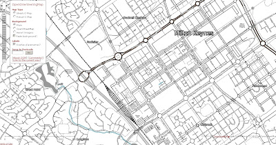
OpenOrienteeringMap is an orienteering map of the whole of the UK, based on OpenStreetMap data. There are two map types – “Street-O” and “Pseud-O”.

OpenOrienteeringMap Pseud-O Map Mode
The Pseud-O map is a less serious map (as the level of detail in OSM is not sufficient for “proper” orienteering maps) but attempts to emulate the look and feel of standard orienteering maps.

OpenOrienteeringMap Street-O Map Mode
The Street-O map contains the level of detail equivalent to the Street-O maps used for informal orienteering races around the streets of London and other urban areas in the UK. [...]
No comments:
Post a Comment