
Story telling med gamle kort ...
/Sik

Story telling the mapping way ...
/Sik
Quote
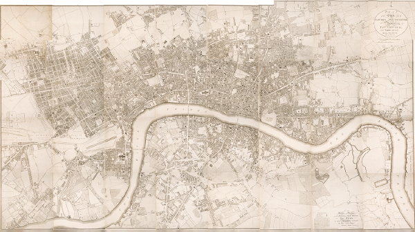
The Grub Street Project is a digital edition of 18th-century London. It aims to map the city and its texts to create both a historically accurate visualization of the city's commerce and communications, and a record of how its authors and artists portrayed it.
Grub Street, now subsumed by Milton Street, was both a real place and an abstract idea. For authors such as Alexander Pope and Jonathan Swift, it represented base commercialization, hack writing, and the prostitution of literary ideals. Its historical record, however obscure, presents a more complex scene, and one that is difficult to trace. Where, exactly, was "over against the lower Pump in Grub-street" (where one might find the printer John Clowes) or "in Grub-street neer the upper pump" (Bernard Alsop) or "near the Upper-Pump in Grubstreet" (Elizabeth Alsop)? What is left to us are the traces of this topography in maps (Strype, Horwood), in texts (The Dunciad), and in images.
Both location and metaphor, this now-vanished street represents what is largely invisible to us now, the print culture of 18th-century London (both high and low), and the construction of 18th-century London as a network of textual representations. The Grub Street Project will examine new possibilities that digital mapping provides to better understand the city as topography and as "social text."
Read more: http://grubstreetproject.net/index.html
No comments:
Post a Comment