Wednesday, December 30, 2009

The NYPL Map Rectifier


Smart card ...
/Sik


Cool tool ...
/Sik


Quote

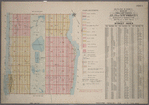
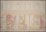
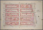
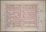
The NYPL Map Rectifier is a tool for digitally aligning ("rectifying") historical maps from the NYPL's collections to match today's precise maps. Visitors can browse already rectified maps or assist the NYPL by aligning a map. Play the video above to tour the site and learn how to rectify a map yourself.

Everyone is welcome to participate!

?t=t&id=1524465
from Atlas of the city of New York, borough of Manhattan. From actual surveys and official plans / by George W. and Walter S. Bromley. (In 2 layers)
about 1 year ago.Unrectified.
?t=t&id=1524458
from Atlas of the city of New York, borough of Manhattan. From actual surveys and official plans / by George W. and Walter S. Bromley. (In 2 layers)
about 1 year ago.Unrectified.
?t=t&id=1524448
from Atlas of the city of New York, borough of Manhattan. From actual surveys and official plans / by George W. and Walter S. Bromley. (In 2 layers)
about 1 year ago.Unrectified.
?t=t&id=1524447
from Atlas of the city of New York, borough of Manhattan. From actual surveys and official plans / by George W. and Walter S. Bromley. (In 2 layers)
about 1 year ago.Unrectified.
?t=t&id=1531750
from Borough of Richmond, Topographical Survey. (In 2 layers)
about 1 year ago.Unrectified.


Read more: http://maps.nypl.org/warper/

No comments:

Post a Comment