Friday, October 2, 2009

Free Sampling Design Tool Extension For ArcGIS


Jeg er ikke helt sikker på hvad det gør ...
/Sik


Useful for some ...
/Sik


Quote

The Sampling Design Tool is another free ArcGIS extension from NOAA’s Center for Coastal Monitoring and Assessment, the source of the Habitat Digitizer Extension I posted about last week. Key features (from the PDF manual): [...]

Signs that indicate you may be a GeoGeek


Er du en geo nørd?
/Sik


Are you a geo geek?
/Sik


Quote

Chances are good that if you are a Geo Geek then you already know it and likely refer to yourself as one. However, there’s many of you out there that may be on the fence and wondering… “am I a Geo Geek?" Read on for a comprehensive list of signs you might be a GeoGeek [...]

Read more: http://www.gisuser.com/content/view/18624/28/

Nice Map


FYI
/Sik


FYI
/Sik


Quote

Nice Map is a WMS client for Drupal. It comes with views module support and should work with latitude/longitude data stored by location module, geo module or basic cck number fields.

Here are some examples of sites using the Nice Map module:

Pandemic Preparedness Capacity Map
http://preparedness.interaction.org

InterAction: Contributions to Millennium Development Goal
http://preparedness.interaction.org/foodsecurity

Stumble Safely
http://StumbleSafely.com

OutSideinDC Bikes
http://outsideindc.com/bikes

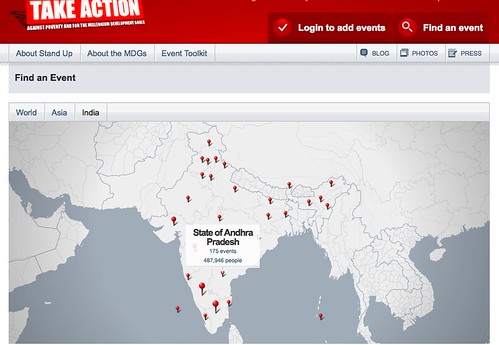
United Nations: Stand Against Poverty
http://StandAgainstPoverty.org/en/events/map


Read more: http://drupal.org/project/nicemap

iphone navigation with motionx and bing maps


FYI
/Sik


iBing ...
/Sik


Quote

The application has a ton of hot features including a base map using Bing Maps for visualizing location information. Check out the full list of navigational features:

Bing Maps on MotionX-GPS Drive

  • Driving Directions – Full step-by-step driving directions to navigate you to your destination.
  • Walking Directions – Want to keep it green? Live in NYC? Use the walking directions feature to find your way.
  • Familiar Search - Just type and search. With the advanced MotionX Find-N-Go™ technology, you can Find anything, anywhere and then just follow the directions. Driving or walking it's that simple.
  • Optimized Compass - any time know where your destination is, even if you parked your car a few blocks away, MotionX will take you right there. If you don't have a 3GS yet, the compass also works with GPS motion sensing on the iPhone 3G.
  • Address Book Integration - Integrated with iPhone address book quickly and easily reference navigation to friends
  • iPod Integration – Access playlists and listen to your music, audiobooks, and podcasts while using MotionX.
  • Phone Integration - Place a phone call directly from search results.

MotionX-GPS Drive


Read more: http://www.bing.com/community/blogs/maps/archive/2009/09/25/iphone-navigation-with-motionx-and-bing-maps.aspx

Charting the Final Frontier--Google Maps for Indoors


Google finder den korteste vej fra soveværelset og til køkkenet ...
/Sik


Big Brother is mapping you ... Give me directions to the kitchen please ...
/Sik


Quote

[...]

Available as a free service to users of the iPhone, BlackBerry, Palm or Android mobile handsets, Micello displays the Google maps to an address adorned with icons showing where indoor maps are available. Once the user arrives at an address, clicking on the Micello icon overlays the indoor map. Search for a particular venue inside, and Micello highlights a recommended route from your current location. Future versions will also provide directions from your car in the parking lot, as well as store-to-store directions once inside a mall.

Micello also plans to personalize maps by highlighting items that may be of interest to users based on their profile and history, as well as allow them to share their location with Facebook friends, Twitter followers or LinkedIn contacts. In addition, users will be encouraged to crowd-source information about destinations by posting reviews about points of interest.

When Micello becomes available later this fall for the iPhone, it will come with maps for 150 points of interest in the Bay Area, with the rest of California slated for mapping by the end of the year. The other major cities, plus versions for BlackBerry, Palm and Android, are promised by the end of 2010, at which time Micello estimates it will have 5,000 shopping malls, 10,000 college campuses and 400 convention centers in its growing database. Locations will also include airports, stadiums, theme parks, golf courses, fitness centers and other venues where people naturally congregate. [...]


Read more: http://www.smartertechnology.com/c/a/Technology-For-Change/Charting-the-Final-FrontierGoogle-Maps-for-Indoors/

GIS Is Key to 21st Century Skills


Der er GIS i alt - vor tids teknologi har synliggjort dette for de fleste - så uanset hvad man arbejder med kan man kun blive bedre med GIS kundskaber ...
/Sik


GIS is in everything - technology today has made it obvious for most - no matter what you work with you need GIS skills ...
/Sik


Quote

Educational researchers and policymakers increasingly call for “21st Century skills.” What exactly are these skills, and why are they important for education? One advocacy organization focused on this is the Partnership for 21st Century Skills, which since 2002 has brought together business, education, and policy leaders to define these skills and indicate how they can be applied to education. These skills include information and communication, thinking, problem-solving, interpersonal and self-direction, global awareness, economic and business literacy, entrepreneurial, and civic literacy. The Partnership’s belief is that “every child in America needs 21st Century knowledge and skills to succeed as effective citizens, workers, and leaders” and that a gap exists between this knowledge and skill set and what students are currently learning in school.

Recently, diverse groups gathered to produce “skills maps” that connect these skills with specific content areas. Thus far, English, Social Studies, Science, and Geography skills maps have been completed. The National Council for Geographic Education formed a team, including NCGE members from ESRI, universities, and schools, to create the Geography Map [PDF]. Geotechnologies such as Geographic Information Systems, GPS, and Remote Sensing are prominently featured throughout this document. The reason why is that they can serve as powerful tools for spatial inquiry, fostering critical thinking skills about a host of issues from local to global—from natural hazards to population to invasive species, and beyond. Because GIS is a system, using it requires the ability to gather, manage, and make decisions based on real data in real contexts.

In an interview for the article, “New maps infuse 21st Century Skills”, I stated that geotechnologies help students “engage in spatial analysis and inquiry that will prepare them for today’s rapidly changing world.” For example, eighth-graders identify historic and contemporary migrant groups in their area, examine why migration occurs, investigate the changes that occur when people migrate, and present their findings.

It is our hope that these 21st Century skills maps encourage administrators and educators to infuse these skills into the curriculum to best prepare students for the future.

- Joseph Kerski, ESRI Education Manager


Read more: http://blogs.esri.com/Info/blogs/gisedcom/archive/2009/10/02/gis-is-key-to-21st-century-skills.aspx

Strange Maps: An Atlas of Cartographic Curiosities

Book

Cover Image

An intriguing collection of more than one hundred out-of-the-ordinary maps, blending art, history, and pop culture for a unique atlas of humanity

Spanning many centuries, all continents, and the realms of outer space and the imagination, this collection of 138 unique graphics combines beautiful full-color illustrations with quirky statistics and smart social commentary. The result is a distinctive illustrated guide to the world. Categories of cartographic curiosities include: • Literary Creations, featuring a map of Thomas More's Utopia and the world of George Orwell's 1984

• Cartographic Misconceptions, such as a lavish seventeenthcentury map depicting California as an island
• Political Parody, containing the "Jesusland map" and other humorous takes on voter profiles
• Whatchamacallit, including a map of the area codes for regions where the rapper Ludacris sings about having "hoes"
• Obscure Proposals, capturing Thomas Jefferson's vision for dividing the Northwest Territory into ten states with names such as Polypotamia and Assenisipia
• Fantastic Maps, with a depiction of what the globe might look like if the sea and land were inverted

The Strange Maps blog has been named by GeekDad Blog on Wired.com "one of the more unusual and unique sites seen on the Web that doesn't sell anything or promote an agenda" and it's currently ranked #423 on Technorati's Top 500 Blogs.

Brimming with trivia, deadpan humor, and idiosyncratic lore, Strange Maps is a fascinating tour of all things weird and wonderful in the world of cartography.


Buy: http://search.barnesandnoble.com/Strange-Maps/Frank-Jacobs/e/9780142005255/?itm=1